Scroll down for freelance and hobby projects
Maps for Woodwell Climate Research Center
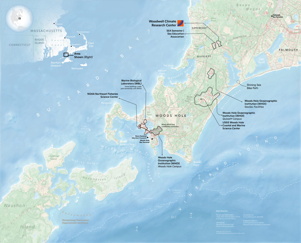
Woodwell Climate Research Center Entrance Map
Created a new map to be displayed in the entrance hall at each level of the Woodwell Climate Research Center main building in Falmouth, MA.
September – November 2021
Tools used | ArcGIS Pro, Blender, Photoshop, Illustrator
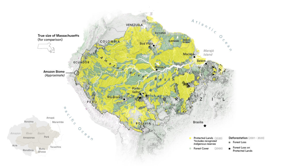
Protected Lands and Deforestation in the Pan-Amazon Biome
Adapted from a poster for a Axios feature on conservation in the Amazon.
Read the story here.
October 2021
Tools used | ArcGIS Pro, Photoshop, Illustrator
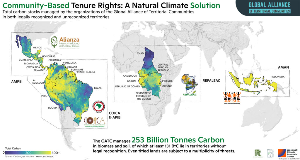
Global Alliance Carbon Stocks
Created posters to support the Rainforest Foundation and Global Alliance in their communication work, including at COP 2021. Read the story here.
July – October 2021
Tools used | ArcGIS Pro, Illustrator
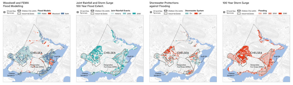
Flooding in Chelsea
Supported a report to the City of Chelsea with figures showing flooding, flood models and protective infrastructure.
July – August 2021
Tools used | ArcGIS Pro, Illustrator

Climate Risk in North Korea
Created figures and graphics for a Story Map on climate risk in North Korea.
Read the story here.
April – July 2021
Tools used | ArcGIS Pro, ArcGIS Online, Blender, Photoshop, Illustrator
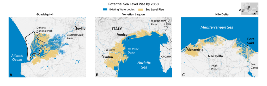
Climate Risk in the Mediterranean
Figures showing sea level rise at select sites in Europe and Africa to support a risk report on Climate Risk.
April – May 2021
Tools used | ArcGIS Pro, Illustrator
Freelance Work (and for fun!)
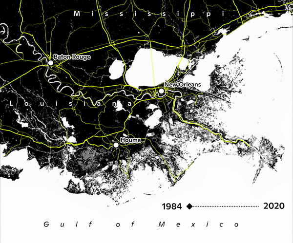
Land Subsidence in Louisiana
A animation showing 37 years of erosion on the Louisiana delta region. Commissioned for a student project out of Colorado State University.
November 2021
Tools used | Google Earth Engine (Javascript), Photoshop
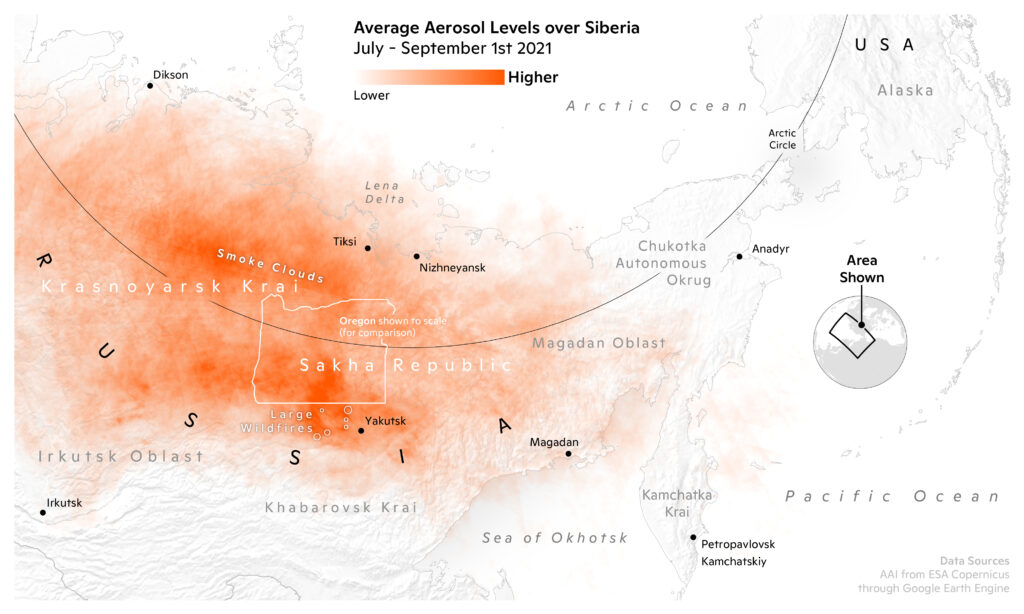
Aerosol Levels over Siberia
Made as part of the #30dayMapChallenge.
November 2021
Tools used | Google Earth Engine (Javascript), ArcGIS Pro, Illustrator
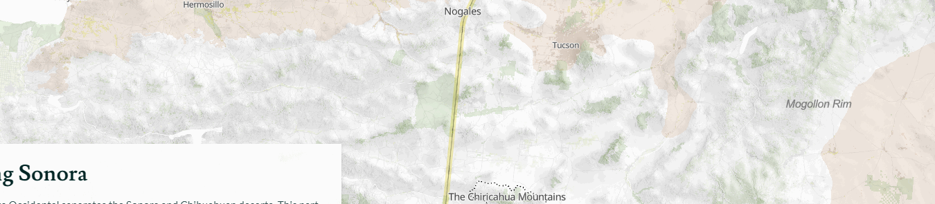
The Chihuahuan Desert
A Story Map on the Chihuahuan Desert for a discord mapping competition.
Read the story here.
July 2021
Tools used | ArcGIS Pro, ArcGIS Online, Power BI, Google Earth Engine (Javascript), D3 and Observable.Plot, Blender, Photoshop, Illustrator
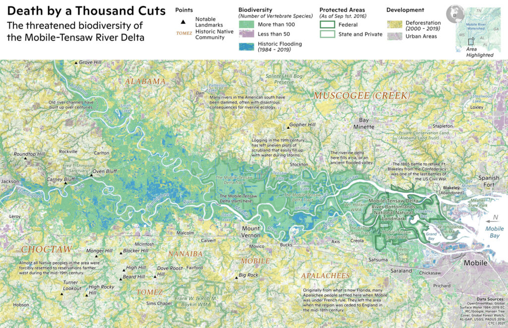
Death by a Thousand Cuts
A exploration of the history and current conservation state of the Mobile-Tensaw Delta in Alabama.
January – February 2021
Tools used | ArcGIS Pro, Blender, Photoshop
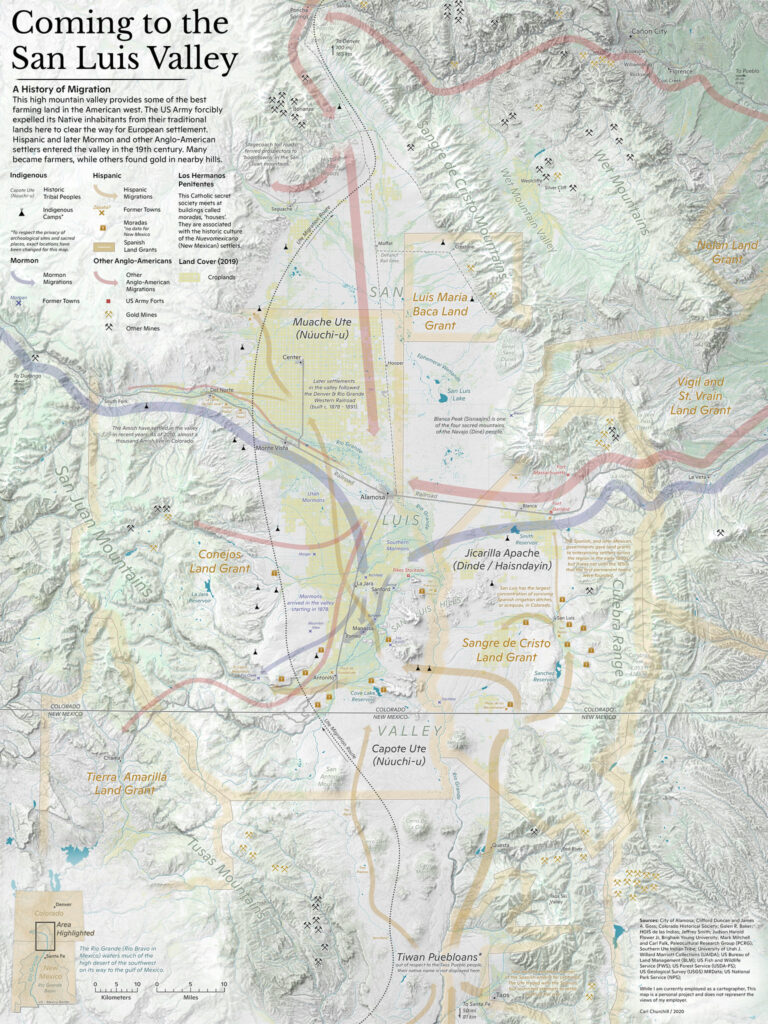
Coming to the San Luis Valley
A research project on the history of the San Luis Valley in Colorado and New Mexico. Adapted from a earlier Story Map.
January – October 2020
Tools used | ArcGIS Pro, Blender, Photoshop
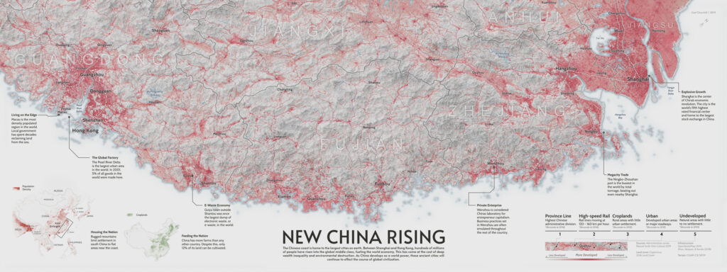
New China Rising
A infographic about the pace of urbanization on Chinas eastern and southern coast.
November 2019 – January 2020
Tools used | ArcGIS Pro, Blender, Photoshop
I have made hundreds of maps over my short career, a lot more than is shown above. Check out my full published collection here.